HFSS: During GDS importing, Elevation in Tech is not being used.
时间:03-30
整理:3721RD
点击:
Hi,
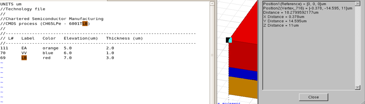
I am trying to import GDS file exported from Cadence into HFSS14. For this purpose, I have created a tech file to map thickness and elevation but HFSS ignores elevation info and takes only thickness I think because when I try to overlap some layers and leave some space between layers, HFSS ignores elevations and abuts all layers to each other using their thickness. In other words, there is no overlap or spacing although tech file states like that. Below is the one example of tech file I am using:
I have attached the screenshot of tech file and results. For this tech file, in HFSS, top of LB is 11um but it should be 10um. Am I missing something?
Thanks,
yayla
I meet the same problem in HFSS14, and the layers are from bottom to top regardless of the parameters of elevation.
I didn't meet this problem in older version of HFSS.
Did you solve this problem?